Liechtenstein
Twenty-five kilometres long, with the Alps filling its eastern half.

- High point
- Grauspitz
- 2599 m
- Elevation
- 455 m
- Nearest station
- Schaan-Vaduz
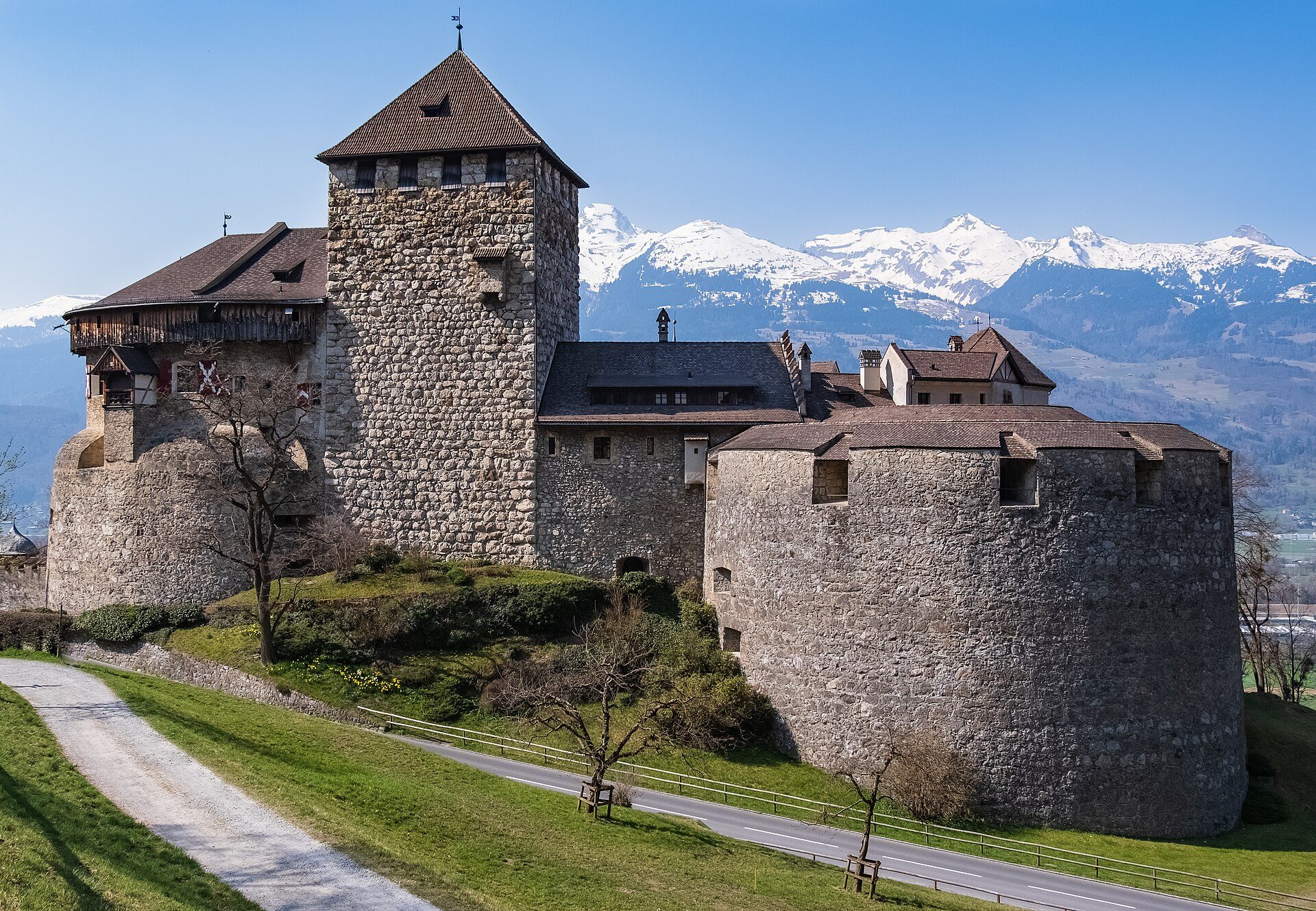
Liechtenstein measures 24.77 kilometres at its longest and lies between Switzerland and Austria; about half of its territory is mountain. It falls into two landscapes, the Rhine plain in the west and high mountains in the east, and the Rätikon shapes its southern and eastern borders, with the border with Austria running mostly along the ridge. Its highest point, the Grauspitz, reaches 2,599 metres on the Swiss border; the ascent from Steg means 1,440 metres of climbing, and the link between the Hintergrauspitz and the Vordergrauspitz is demanding and exposed. Vaduz, the capital, lies along the Rhine at 455 metres, with Vaduz Castle on a steep hill above the town.
The Fürstensteig
The Fürstensteig is an alpine path through the northwest face of the Alpspitz (1,942 metres) in the Rätikon. It was cut into the rock face and opened in 1898, and Prince Johann II paid for it. It starts at Gaflei, where there is a car park and a bus stop, which LIEmobil line 22 reaches from Triesenberg on the days it runs, and climbs to the Gafleisattel; walkers come back down it, loop back to Gaflei by Silum, Bärgälla and Chemi, or carry on over the ridge to the Drei Schwestern and down to Planken. The Drei Schwestern (Three Sisters) are a three-peaked chain on the border with Austria, forming a natural boundary with Vorarlberg. The path does not require climbing, but walkers should be sure-footed and have some head for heights.
Malbun and the high valleys
Malbun, at 1,600 metres, is Liechtenstein’s single ski area. The Liechtenstein Panorama Trail, signposted as Route 66, starts there and runs about 47 kilometres in three stages to Ruggell, taking in the Fürstensteig and the Drei Schwestern on its second stage and passing the hill village of Planken, at 786 metres, on its third; Liechtenstein Marketing describes it as a trail of three to four days. West of the mountains lies the Rhine plain, where most of the population lives, and the country’s lowest point, the Ruggeller Riet at 430 metres.
Getting there
Liechtenstein has no airport, and its single railway line, the Feldkirch-Buchs line, is owned and operated by Austrian Federal Railways (ÖBB), with the S2 of the Vorarlberg S-Bahn serving its stations. Schaan-Vaduz, the station for the capital, is in the town of Schaan, 3.5 kilometres from Vaduz. Liechtenstein’s bus service, LIEmobil, connects to the Swiss bus and train network at Buchs and Sargans.