Bernese Oberland
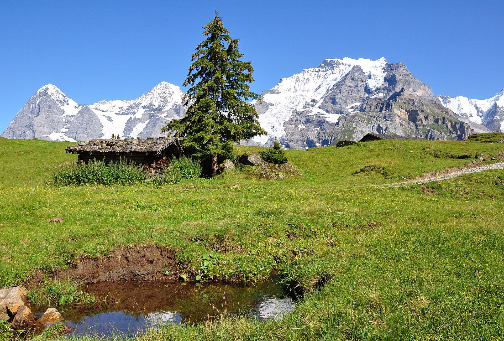
Eiger, Mönch and Jungfrau, above Interlaken and its two lakes.

- Elevation
- 568 m
- Nearest station
- Interlaken
The high ridge
The Bernese Oberland is named for its position: the highest and southernmost part of canton Bern, separated from the Rhône valley by the main Alpine watershed. Its skyline is the Eiger (3,967m), Mönch (a little over 4,100m) and Jungfrau (4,158m), three peaks in a continuous ridge that overlooks the Swiss Plateau. The Jungfrau Railway, opened in 1912, tunnels through the Eiger and the Mönch to reach the Jungfraujoch at 3,454m, the highest railway station in Europe, in the open air only as far as Eigergletscher, at 2,320m. The wider massif, Jungfrau-Aletsch, is a UNESCO World Heritage Site shared with Valais on the far side of the ridge, and includes the Aletsch Glacier, the largest glacier in the Alps.
Interlaken and the two lakes
Interlaken, whose name simply describes its position between Lake Thun and Lake Brienz, is the main transport hub for the region’s mountains and lakes. From there, branch railways climb into the Lauterbrunnen valley, a trough-shaped valley with 72 waterfalls, including the 297m Staubbach Falls beside the village, and on to Wengen and Mürren, two car-free villages reached by rail or cable car.
Walking
Grindelwald, just below the Eiger, has lift access onto the ridge itself, the Eiger Express gondola running to Eigergletscher; Wengen and Mürren, both car-free, look to the same peaks. Away from the Jungfrau massif, Kandersteg sits beneath the Blüemlisalp massif, 3,660m at its highest point, and gives onto both valley walking and cable-car-assisted routes toward Lake Oeschinen; Adelboden and Lenk, the latter at the head of the Simmental, share an extended ski and hiking area. Trails range from the hiking trails that MySwitzerland says need no special requirements beyond ordinary care to via ferrata routes such as the one from Mürren to Gimmelwald, and the region’s cable cars and mountain railways mean a walker can start high without necessarily climbing there on foot.
Season and access
Summer is high season for walking, since trails at higher altitudes may remain snowbound until the summer; winter shifts the same lifts and villages over to skiing. Interlaken is the terminus of the BLS Thunersee line from Bern via Thun, with connections onward to Lucerne over the Zentralbahn’s Brünig line and to Valais over the Lötschberg line from Spiez. The Jungfraujoch is reached in stages: the Berner Oberland-Bahn from Interlaken to Lauterbrunnen or Grindelwald, the Wengernalpbahn on to Kleine Scheidegg, and the Jungfrau Railway from there.
Getting here
The Grimsel Pass, the direct road link south into Valais, closes for winter and reopens in late spring.