Switzerland
Forty-eight peaks over 4,000 metres, and a railway under the Gotthard.

- High point
- Dufourspitze
- 4634 m
- Nearest station
- Bern
- Regions
- 11
Where the mountains are
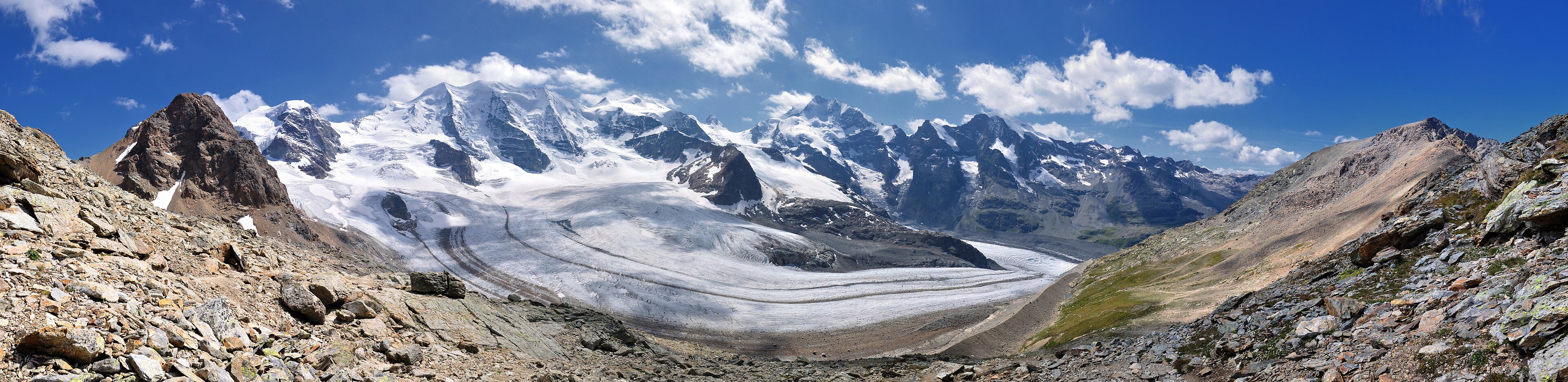
The Alps cover roughly 60 percent of Switzerland’s land area, occupying the south and southeast of the country while the Swiss Plateau, the Mittelland, holding Bern, Zürich and most of the population, sits lower and gentler between them and the Jura. Within the Alps the ranges have their own names and characters: the Pennine Alps along the Italian border in Valais, home to the Matterhorn and to Dufourspitze, the country’s highest point at 4,634m; the Bernese Alps north of the Rhône valley, where the Eiger, Mönch and Jungfrau form one of the most distinctive skylines in the Swiss Alps; the Rhaetian Alps of Graubünden in the southeast, crowned by Piz Bernina; and the Lepontine Alps, which take in Ticino and reach south toward Italy. A separate range, the Jura, runs along the French border in the northwest: limestone ridges rather than glaciated peaks, rising to 1,679m at Mont Tendre.
Four languages, twenty-six cantons
Switzerland has four national languages, and which one is spoken changes what the mountains feel like. German covers the Bernese Oberland, Zürich and most of the north and east; French covers Valais’ lower Rhône valley, the Vaudois Alps and the shores of Lake Geneva; Italian covers Ticino and southern Graubünden; and Romansh, spoken by under one percent of the population, survives in parts of the Engadin and the valleys of Graubünden. The 26 cantons carrying these languages are also why the same mountain range can look administratively different a short distance apart: the Jungfrau stands on the border between Bern and Valais but is approached from the Bernese side, while the Matterhorn is in Valais.
Season
Summer is the walking season at altitude, because trails at higher altitudes may remain snowbound until the summer, as MySwitzerland’s hiking guidance puts it; the lower Alpine regions start earlier, with the hiking season there beginning in spring. Several of the high roads linking one valley to the next, the Furka, the Grimsel and the Great St Bernard among them, close under snow for winter and reopen in late spring; the railway tunnel beneath the Furka and the road tunnel beneath the Great St Bernard run all year regardless.
Getting around
The rail network is the main reason a car is optional in much of Switzerland: SBB’s lines serve all the larger Swiss cities, narrow-gauge lines such as the Rhaetian Railway climb into valleys the main lines do not, and PostBus runs regional and rural services throughout the country. Cog railways add a further layer, built specifically to reach high points such as Pilatus, Rigi and the Jungfraujoch, Europe’s highest railway station at 3,454m. The Gotthard Base Tunnel, opened in 2016 and at 57km the longest railway tunnel in the world, bypasses most of the older Gotthard railway line, which climbed across the massif.
Regions of Switzerland
Bern
The federal city's hill country, well short of the high Alps.
Bernese Oberland
Eiger, Mönch and Jungfrau, above Interlaken and its two lakes.
Eastern Switzerland
Appenzell's Alpstein and the Glarus Alps, east of Zürich.
Graubünden (Grisons)
Switzerland's largest canton, and its only trilingual one.
Jura and the Three Lakes
Watchmaking towns, three lakes, and limestone hills, not glaciers.
Jura, Fribourg Prealps and Vaudois Alps
Three ranges in one corner: Jura, Fribourg Prealps, Vaudois Alps.
Lake Geneva
Switzerland's largest lake, vine-covered along its north shore.
Lake Lucerne
Pilatus and Rigi above the water, reached by two historic railways.
Ticino
South of the Gotthard, Italian-speaking, and mild year-round.
Valais
The Rhône valley, the Matterhorn, and Switzerland's highest ground.
Zurich
Lake-bound, not alpine, but the Uetliberg is reached by train.