Chalets de Miage and Mont Truc from La Gruvaz
Near Saint-Gervais-les-Bains, France
- Distance
- 9.7 km
- Ascent
- 751 m
- Time
- 4 hr 55 min
- Difficulty
- Moderate
- Shape
- Circular
Start: Parking de la Gruvaz, just above the hamlet of La Gruvaz, on the road from Saint-Gervais towards Les Contamines
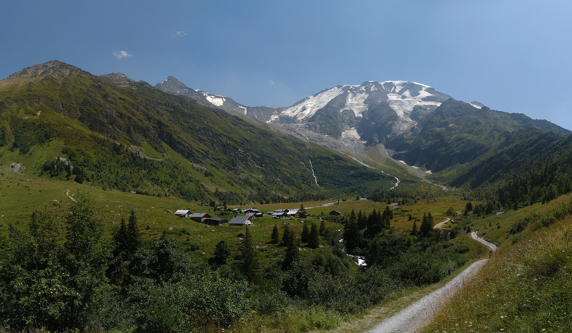
The Chalets de Miage are a group of summer chalets in open pasture south of Saint-Gervais-les-Bains, under the north-west side of the Dômes de Miage. The Dômes are a snow ridge reaching 3,673m on the IGN map, between Saint-Gervais and Les Contamines-Montjoie, first climbed on 2 September 1858 by Edmond Thomas Coleman with Frédéric Mollard and Joseph Jacquemont, and the streams that come off their glaciers run down past the chalets. No lift serves the walk; a track road reaches the chalets, and walkers come up through the hamlets below.
The loop the route guide Visorando gives starts at the Parking de la Gruvaz, at 1,111m, and is best walked clockwise. The first climb, through woods and past a hamlet to the chalets, is the steepest and hardest part of the day, shaded all the way, and takes about two hours; the Tour du Pays du Mont Blanc joins it from Le Champel, which is the alternative start. Beyond the chalets the path follows the stream, crosses it on a footbridge, and climbs again, less steeply, to a col, from which an out-and-back of 20 to 30 minutes across pasture reaches Mont Truc at about 1,806m. A vehicle track leads back down through the forest to La Gruvaz.
The guide gives 9.66km, 751m of ascent and an average of four hours and 55 minutes, graded medium. The chalets serve food, and the guide advises booking.
This suits a walker who wants a full day under a glacier-hung ridge on paths with no lift on them. The hardest climb comes first, two hours of it, which rules it out for anyone who wants a short day or a lift to take the height; the Prarion walk, from the Bellevue cable car above Les Houches, faces the Bionnassay and Goûter peaks with 210m of ascent.
Underfoot
A steep shaded climb through woods and hamlets to open pasture at the chalets, a stream crossing on a footbridge, a second steep climb to a col and an out-and-back to Mont Truc, then a vehicle track back down through forest.
Stay within reach of the start
Booking through these links earns a commission. The price is the same.
Distances, ascent and times here are planning figures taken from published sources, not a route description to navigate by. Take a map and check the forecast.