High Pike from Caldbeck
Near Caldbeck, Lake District
- Distance
- 9.5 km
- Difficulty
- Moderate
- Summit
- 658 m
- Shape
- There and back
- Parking
- Free
Start: Caldbeck village car park, beside the path to the Howk
Grid ref: NY 323399
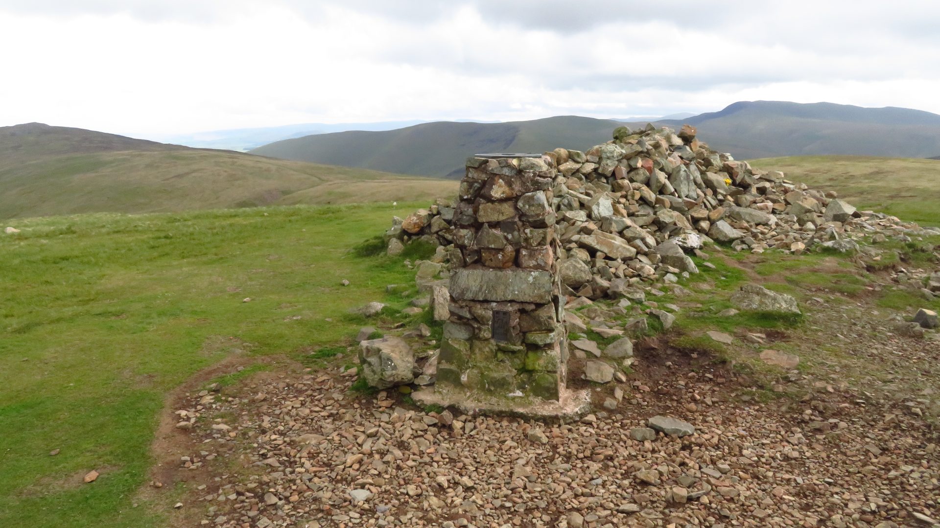
High Pike is the closest fell to Caldbeck, and the walk starts in the village rather than at a roadside lay-by. Wikipedia and WalkLakes both give its height as 658m and place it 4.5km south of the village on grid reference NY 318350. It is a Wainwright, a Hewitt and a Nuttall, and the mountaineer Chris Bonington, who lives in Caldbeck, is quoted on the Wikipedia page as calling it a hill he feels truly at home on.
The route follows the Cumbria Way the whole distance, which means waymarks rather than navigation. The start is the village car park, which the Lake District National Park describes as free, close to the centre and open to voluntary donations. From there the path leaves by Gill Beck and Townhead, passes through Nether Row, and climbs by Low Pike onto the north-facing slope of the main fell; Lakeland Routes lists the same line, via an old mine road past Potts Gill, as part of its circuit. The fell was worked for centuries: Wikipedia records 23 different ores taken from the Roughtongill mine alone since the sixteenth century, and barytes was extracted in the Second World War until 1966. Lakeland Routes warns that unfenced shafts lie close to the path on the upper slopes and asks that dogs and children be kept on leads near them.
The summit carries a large cairn and wind shelter built from the stones of a ruined shepherd’s cottage, a trig pillar eight metres to the north that WalkLakes records as slightly lower, and a slate bench inscribed to Mick Lewis, who “loved all these fells”. GPS-Routes gives the walk as 5.9 miles (9.5km) there and back, and about three hours up; other guides route it as a longer loop returning by Hesket Newmarket.
This suits anyone with a few hours who wants a summit on a waymarked path with no scrambling. Someone after rock, exposure or a ridge should look elsewhere, because the ground is grass and old mine track throughout. For a steeper climb to a higher summit from Keswick, Skiddaw from Keswick is the nearest equivalent.
Underfoot
Lanes and field paths out of the village, then a waymarked path on open grass and old mine tracks up the north face of the fell; unfenced mine shafts lie close to the route on the upper slopes.
Stay within reach of the start
Everything here is inside 12 km of High Pike from Caldbeck.


Distances, ascent and times here are planning figures taken from published sources, not a route description to navigate by. Take a map and check the forecast. We do not publish conditions, because nothing on this page is updated often enough for you to trust it on the day.