Aiguillette des Posettes from Le Tour
Near Argentière, France
- Distance
- 8.2 km
- Ascent
- 850 m
- Time
- 4 hr 15 min
- Difficulty
- Moderate
- Summit
- 2,201 m
- Shape
- Circular
Start: The gravel lift car park at Le Tour, above Argentière
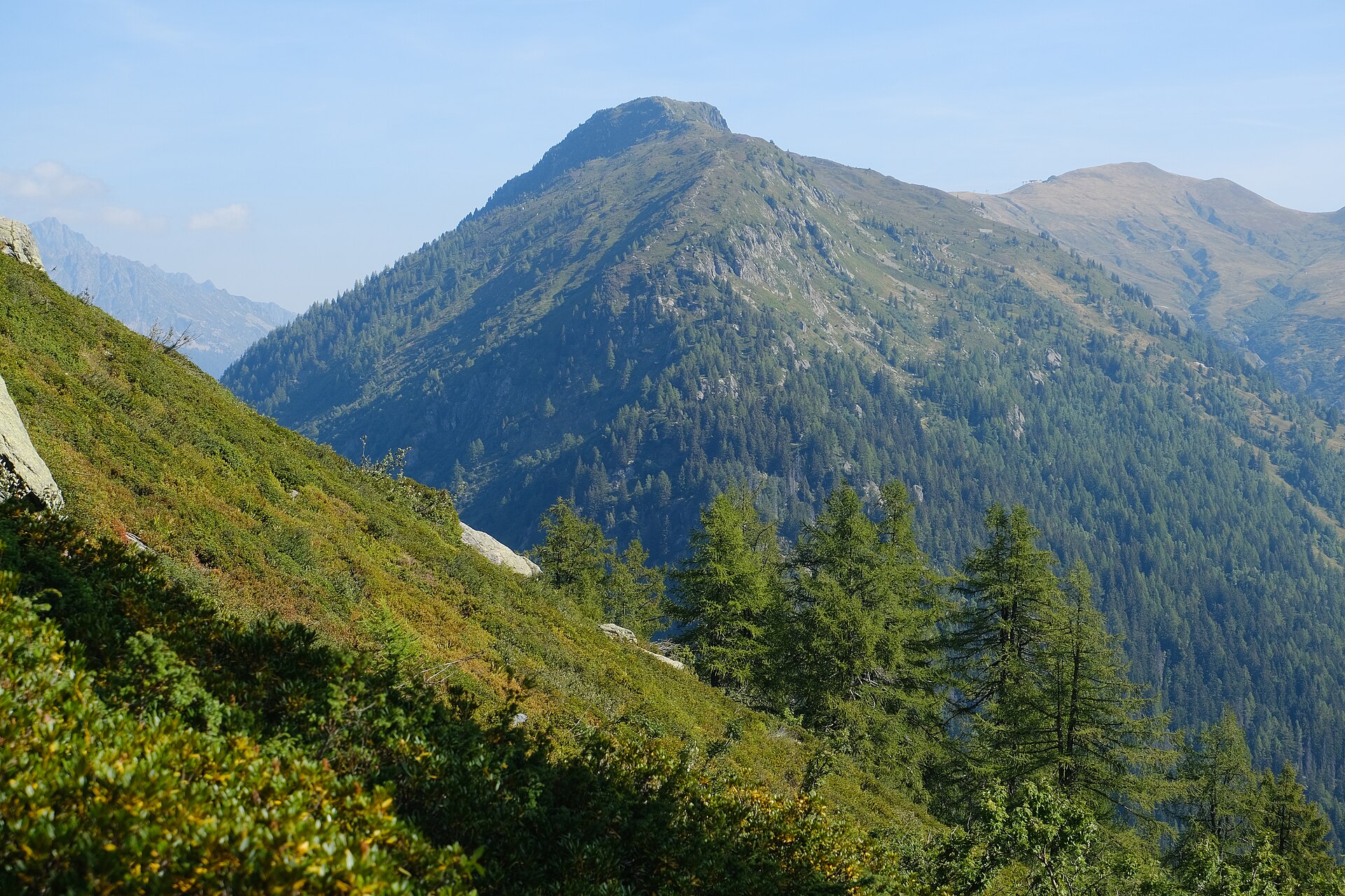
The Aiguillette des Posettes is a summit at 2,201m at the eastern end of the Chamonix valley, above Vallorcine, and the route guide Randos-MontBlanc calls its panorama one of the most extensive in the massif: the Aiguilles Rouges, the Buet, the Glacier du Tour, the Albert Premier refuge and the Emosson dam over the Swiss border. It is climbed from the hamlet of Le Tour, above Argentière, with no lift involved, and the summit is a true top rather than a shoulder on the way to something higher.
The loop that guide describes leaves the gravel lift car park at Le Tour on a waymarked path into the forest, then climbs more steeply into the open, between the avalanche barriers that protect the hamlet, with Le Tour, the Col de Balme and the Charamillon lifts below. Higher up the path runs through low bilberry scrub and across a wide slate field to the ridge, which looks down on Vallorcine, and a short steeper path finishes at the summit. The return follows the ridge and drops back into the forest on short, fairly steep bends where exposed roots are slippery in wet weather, crossing a wooden footbridge to rejoin the outward path.
The guide gives 8.2km and 850m of ascent, with two hours up and two and a quarter down, and grades it intermediate; the map is IGN 3630 OT. The other approach, from Tré-le-Champ below the Col des Montets, is a different matter for dogs. The 2010 decree that governs the Aiguilles Rouges reserve lets hunters’ dogs use the paths from Tré-le-Champ to the montagne des Posettes, on a lead and in the hunting season only; that puts those paths inside the reserve, where every other dog is banned.
For a summit and a full view of the upper valley on a half day, without paying for a lift, this is the walk. All 850m are on foot, which rules it out for anyone who would rather a lift did the climbing; the Col de Balme above the same car park can be reached with the Charamillon gondola taking part of the height, and the Lac Blanc walk starts from a lift at 1,877m on the other side of the Col des Montets.
Underfoot
A waymarked path through forest, then steeper open ground among avalanche barriers and low bilberry scrub, across a slate field to a ridge and a short steeper pull to the summit. The descent back into the forest takes short, fairly steep bends where roots are slippery in the wet.
Stay within reach of the start
Booking through these links earns a commission. The price is the same.
Distances, ascent and times here are planning figures taken from published sources, not a route description to navigate by. Take a map and check the forecast.