Carrock Fell from Mosedale
Near Caldbeck, Lake District
- Distance
- 11.4 km
- Ascent
- 530 m
- Difficulty
- Moderate
- Summit
- 661 m
- Shape
- Circular
- Parking
- Roadside only
Start: Grass verge near Stone Ends Farm, on the minor road north from Mosedale towards Hesket Newmarket
Grid ref: NY 353337
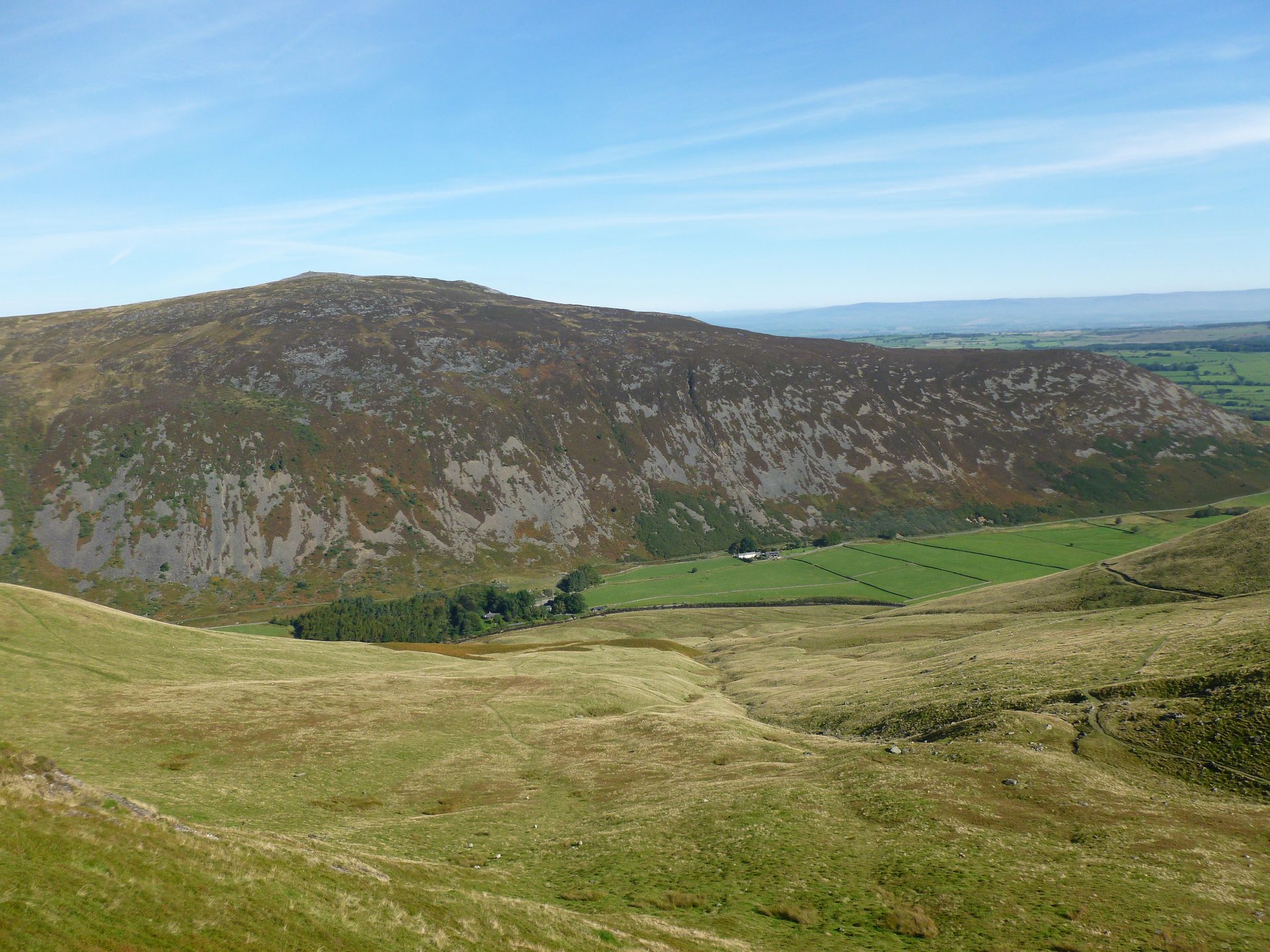
Carrock Fell is 661m high according to Wikipedia, which notes that Ordnance Survey recorded it as 663m for many years, and its geology is, in Wikipedia’s words, unique in the Lake District, being predominantly gabbro rather than Skiddaw Slate. That matters to a walker with a compass: WalkLakes records magnetic iron ore at Further Gill Sike, beside the usual way up, that affects compass readings. The walk starts at Mosedale, on a minor road about seven kilometres south-east of Caldbeck as measured between the two grid references, so it is a short drive and not a walk from the village.
Walking Britain’s route, 11.4km with 530m of ascent and about five hours, climbs steeply to the cairn on Carrock Fell, then follows the high ground over Round Knott and Miton Hill to High Pike before dropping past old mine workings to Carrock Beck and the lane. WalkLakes grades the direct ascent by Rake Trod as steep and loose, and names a groove called Red Gate as the easier alternative. The summit is a Scheduled Monument, listed by Historic England as a large univallate hillfort: an oval enclosure of about 245m by 112m inside a drystone rampart up to 3m high. Historic England calls it the third largest hillfort in the north of England, and notes that it has had only limited antiquarian investigation.
The lower slopes are industrial. Carrock Mine opened in 1854 and, as Wikipedia records, was the only source of tungsten in Britain outside Devon and Cornwall; it closed in 1981 and the site was bulldozed and landscaped in 1988. Dickens and Wilkie Collins climbed the fell in 1857, later drawing on it for The Lazy Tour of Two Idle Apprentices. Walking Britain warns that the wild ponies here are used to being fed and can be too friendly, and WalkLakes says dogs need supervision among the sheep.
This suits a walker who wants a real summit with something on top of it and is content with a steep half-day. The first climb is steep and loose, so anyone expecting a gentle village path should look elsewhere, as should anyone who wants a ridge with exposure. For that, Blencathra from Threlkeld is the Northern Fells’ proper mountain day, and for a gentler day on the same fells the waymarked Cumbria Way path to High Pike starts in the village.
Underfoot
Steep, loose ground on the direct ascent beside Further Gill Sike, then grassy fell with scree patches across Round Knott and Miton Hill to High Pike, returning by old mine workings and a track beside Carrock Beck.
Stay within reach of the start
Everything here is inside 12 km of Carrock Fell from Mosedale.
Distances, ascent and times here are planning figures taken from published sources, not a route description to navigate by. Take a map and check the forecast. We do not publish conditions, because nothing on this page is updated often enough for you to trust it on the day.