The Fairfield Horseshoe from Ambleside
Near Ambleside, Lake District
- Distance
- 16.4 km
- Ascent
- 1080 m
- Time
- 5.1 hr
- Difficulty
- Hard
- Summit
- 873 m
- Shape
- Circular
Start: Rydal Road car park, Ambleside
Grid ref: NY 376047
Fairfield is the highest point of the horseshoe ridges above Ambleside in the Lake District’s Eastern Fells, and Ordnance Survey data puts its summit at 873m, grid reference NY358117. The hill is classed as a Wainwright, a Hewitt, a Nuttall and a Marilyn, a set of listings that between them mean it is both one of Alfred Wainwright’s 214 fells and a genuinely prominent summit rather than a shoulder of a bigger one. Its southern flank is gentle grass; its northern face, above Deepdale, falls away in precipice and scree that the horseshoe route avoids entirely by keeping to the ridges on either side. Grisedale Tarn, just west of the summit, is the tarn where legend has Dunmail’s crown thrown after his defeat near the pass below that still carries his name.
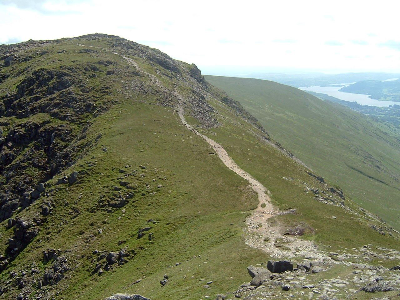
The standard round starts from the Rydal Road car park in Ambleside and climbs Nook Lane past Low Sweden Bridge onto the eastern ridge, following it over Low Pike and High Pike, boggy in places, to Hart Crag. From there the route crosses to Fairfield’s summit plateau and turns for home along the western arm, over Great Rigg, Heron Pike and Nab Scar, descending through the grounds of Rydal Hall back into Ambleside. The route guide walklakes.co.uk records the full circuit as 16.4km with 1,080m of ascent and rates it the hardest grade on its five-point scale, with a minimum time of 5 hours 5 minutes for a party moving steadily.
That is a long day on grass and stony paths with no scrambling in it, and it suits a walker comfortable holding a bearing across a broad, cairned plateau that gives few clues in poor visibility; the eight tops and the featureless summit crossing are what catch parties out, not any scrambling. It does not suit anyone after a short outing from the town: for that, Loughrigg Fell is well under half the height, or Wansfell Pike gives a steep half-day that starts in the town without committing to the full ridge.
Underfoot
Clear fell paths over grass and rock, boggy in stretches on the eastern ridge between Low Pike and High Pike. Fairfield's summit is a broad, stony plateau ringed by cairns and shelter walls, featureless and easy to lose a bearing on in cloud.
Stay within reach of the start
Everything here is inside 12 km of The Fairfield Horseshoe from Ambleside.

Distances, ascent and times here are planning figures taken from published sources, not a route description to navigate by. Take a map and check the forecast. We do not publish conditions, because nothing on this page is updated often enough for you to trust it on the day.