Loughrigg Fell from White Moss
Near Ambleside, Lake District
- Distance
- 4.9 km
- Ascent
- 273 m
- Moving time
- 1 hr 30 min
- Difficulty
- Easy
- Summit
- 335 m
- Shape
- Circular
- Parking
- Paid
- Dogs
- Yes: on a lead near livestock, the National Park asks
Start: White Moss Common car park, on the A591 between Ambleside and Grasmere
Grid ref: NY 348064
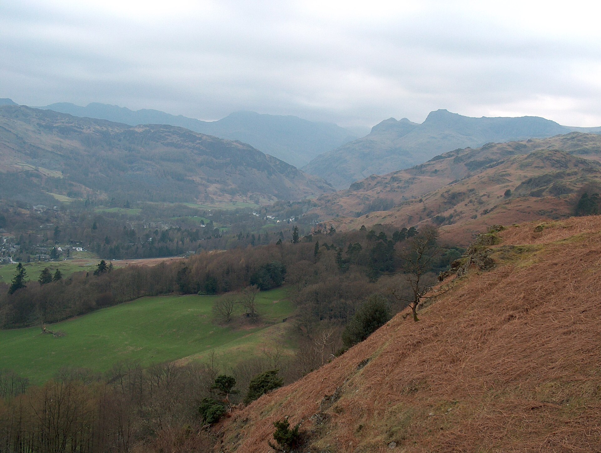
Loughrigg Fell sits in the gap between Ambleside, Grasmere and Rydal, low enough and central enough that paths reach it from almost every direction. The most straightforward, generally rated the easy way up, starts from White Moss Common car park, on the A591 between Ambleside and Grasmere. WalkLakes takes it through White Moss Wood and along the fellside to Rydal Cave, then up past the cave, around 273 metres of climbing in all, to the summit, returning by Loughrigg Terrace, the path above Grasmere.
The top is not a single point but a wide, undulating stretch of bracken, rock and short grass, scattered with small tarns that catch the sky on a clear day. It makes a good introduction to fell walking precisely because it lacks the single dramatic ridge or summit of somewhere like Catbells: instead there is space to wander, several possible high points to visit, and views in most directions, out to the Fairfield horseshoe, down to Windermere, and across to the Coniston fells.
Because so many paths converge here, from Ambleside via Miller Bridge, from Skelwith Bridge, and from Grasmere, it is easy to link Loughrigg into a longer day rather than treat it as the short round from White Moss, a loop WalkLakes gives as 4.9km. On its own it suits anyone wanting a short, unintimidating climb with a summit feel. WalkLakes lists no dog issues, and the Lake District National Park asks that dogs be kept on a lead near livestock. Those who want one clear path to follow without occasionally checking a map should look elsewhere, since the criss-crossing network of paths on top can be confusing in mist.
Underfoot
Woodland and a fellside track to Rydal Cave, then a steeper pull to the wide, undulating summit plateau, where a scatter of small tarns sits among bracken and rock; the return drops to Loughrigg Terrace above Grasmere.
Stay within reach of the start
Booking through these links earns a commission. The price is the same.
Distances, ascent and times here are planning figures taken from published sources, not a route description to navigate by. Take a map and check the forecast.