Helm Crag from Grasmere
Near Ambleside, Lake District
- Distance
- 6.4 km
- Ascent
- 341 m
- Time
- 1.85 hr
- Difficulty
- Moderate
- Summit
- 405 m
- Shape
- There and back
Start: Easedale Road, Grasmere, near the youth hostel
Grid ref: NY 337074
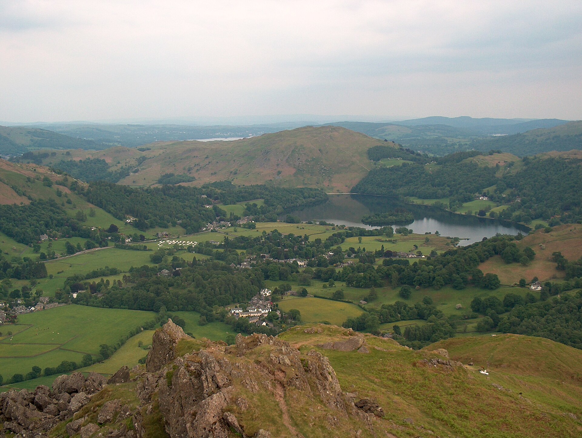
Helm Crag is the small fell that closes off the head of Grasmere’s valley to the north, low by Lakeland standards at 405m but disproportionately well known for the rock formations on its ridge. Seen from the village below, the south-eastern outcrop reads as two shapes long called the Lion and the Lamb, and the ridge’s other rocks carry names of their own, the Old Lady Playing the Organ and the Howitzer. The Howitzer, not the Lion and the Lamb, is the true summit, and reaching its top requires a short, awkward scramble that many walkers choose to leave alone.
The route starts on Easedale Road in Grasmere village, a few miles north of Ambleside on the same corridor the Stagecoach 555 Lakeslink service runs between the two, passing the youth hostel and Goody Bridge before a rough lane, signed as a public bridleway, reaches the foot of the crag. From there, engineered stone steps and zigzag paths climb steadily, with some hands-on scrambling on the higher, looser ground, to gain the ridge below the summit rocks. Walkers not attempting the Howitzer itself can reach the Lion and the Lamb outcrop and the ridge crest without technical climbing; the walk returns by retracing the ascent route rather than as a circuit.
At 6.4km and 341m of ascent, walklakes.co.uk gives a minimum time of under two hours, a realistic half-day even from a late start. It suits anyone based in Ambleside or Grasmere who wants a summit with character in half a day, though the scree and loose rock near the top rule out the final scramble for anyone unsteady underfoot. For a summit of similar height with no scrambling at all, Loughrigg Fell rises between Grasmere and Rydal Water.
Underfoot
A rough lane signed as a public bridleway climbs past Goody Bridge, then engineered stone steps and zigzag paths gain the ridge with some hands-on scrambling higher up; the summit itself is jagged, shattered rock.
Stay within reach of the start
Everything here is inside 12 km of Helm Crag from Grasmere.

Distances, ascent and times here are planning figures taken from published sources, not a route description to navigate by. Take a map and check the forecast. We do not publish conditions, because nothing on this page is updated often enough for you to trust it on the day.