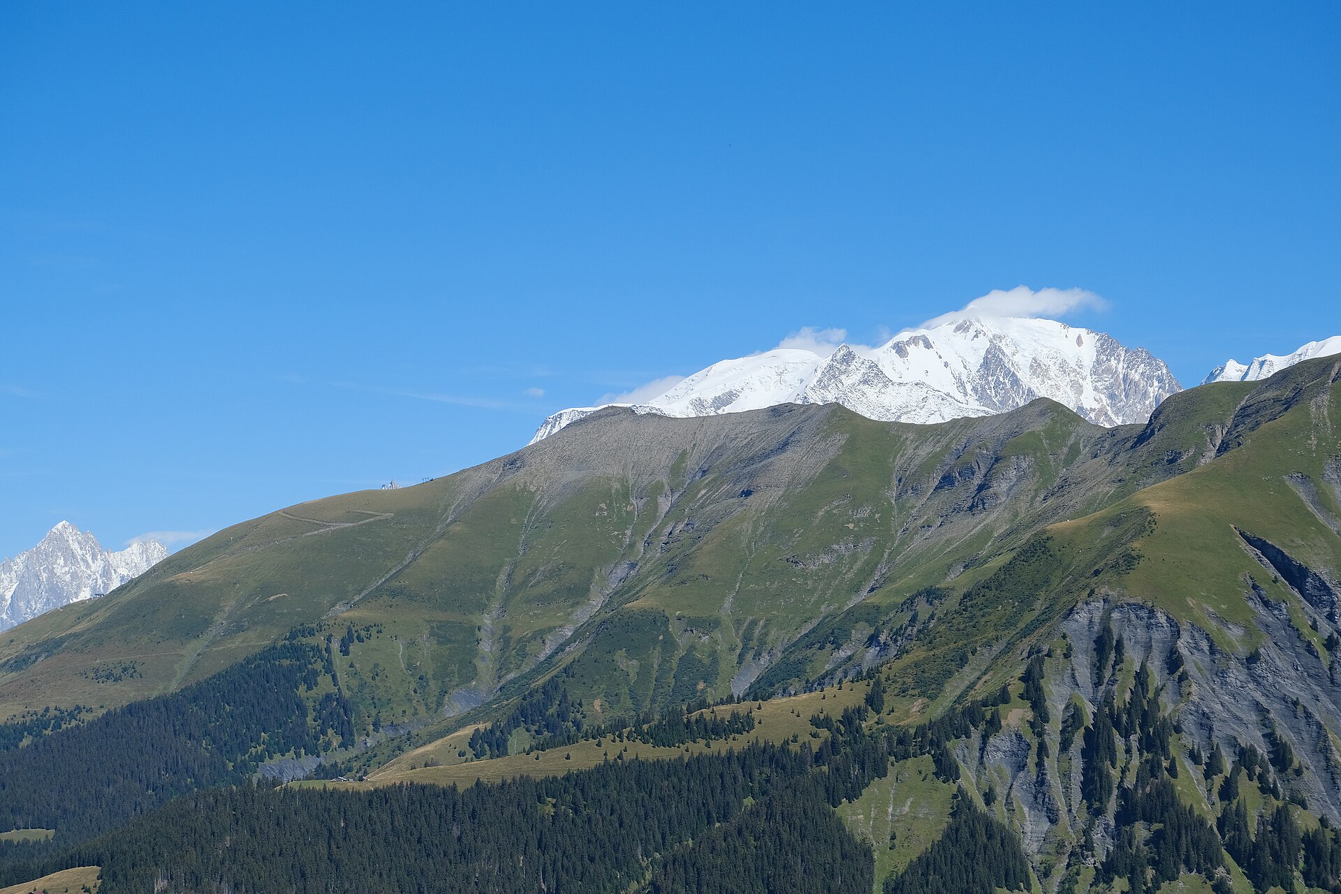
Mont Joly from Megève
Near Megève, France
- Distance
- 16.6 km
- Ascent
- 1,300 m
- Time
- 8 hr
- Difficulty
- Hard
- Summit
- 2,525 m
- Shape
- Circular
Start: The hamlet of Le Planellet, on the Route Edmond de Rothschild above Megève
Mont Joly is the summit at 2,525m on the chain that separates the upper Arly valley, where Megève sits, from the Val Montjoie above Saint-Gervais. It belongs to the Beaufortain rather than the Mont Blanc massif, French Wikipedia records, and it looks across at that massif: the Megève tourist office lists the view from the top as the Mont Blanc range, the Beaufortain, the Aravis and the Bauges. An orientation table and a set of solar-powered weather instruments stand on the summit.
The office’s loop starts at the hamlet of Le Planellet, above the town, and follows the red and yellow waymarks of the Tour du Pays du Mont Blanc up to the top of Mont d’Arbois. From there it goes on by Mont Joux to Mont Joly, then comes down by the chalets and forest of Hermance and the hamlet of Le Planay back to Le Planellet. A chairlift of the Évasion Mont-Blanc ski area reaches the northern ridge about 150m below the summit, but the walk is done on foot from the valley.
The office gives 16.6km and 1,300m of ascent and descent, eight hours, and grades it difficult, a walk reserved, in its words, for experienced walkers. The other way up, from the Plateau de la Croix above Saint-Nicolas-de-Véroce on the Saint-Gervais side, finishes along the crest of Mont Géroux, steeply; the regional tourist board advises against it in bad weather or when storms are forecast, because most of it is on a ridge, and asks for dogs to be kept on a lead.
Mont Joly is for a fit walker with a full day who wants a summit at 2,525m without leaving Megève by car. Eight hours and 1,300m rule it out for a family or anyone new to mountain walking; the Mont d’Arbois and Mont Joux loop takes the first part of the same ridge, with an orientation table on Mont Joux, for about half the climb.
Underfoot
Earth paths on a long climb by Mont d'Arbois and Mont Joux to the summit, then down through the Hermance chalets and forest. Not suitable for pushchairs, the tourist office notes.
Stay within reach of the start
Booking through these links earns a commission. The price is the same.
Distances, ascent and times here are planning figures taken from published sources, not a route description to navigate by. Take a map and check the forecast.