Yr Wyddfa by the Llanberis Path
Near Llanberis, Eryri
- Distance
- 14.5 km
- Ascent
- 975 m
- Time
- 7 hr
- Difficulty
- Hard
- Summit
- 1,085 m
- Shape
- There and back
- Parking
- Paid
- Dogs
- Yes: on a lead across farmland, the Authority asks
Start: Victoria Terrace, Llanberis
Grid ref: SH 582597
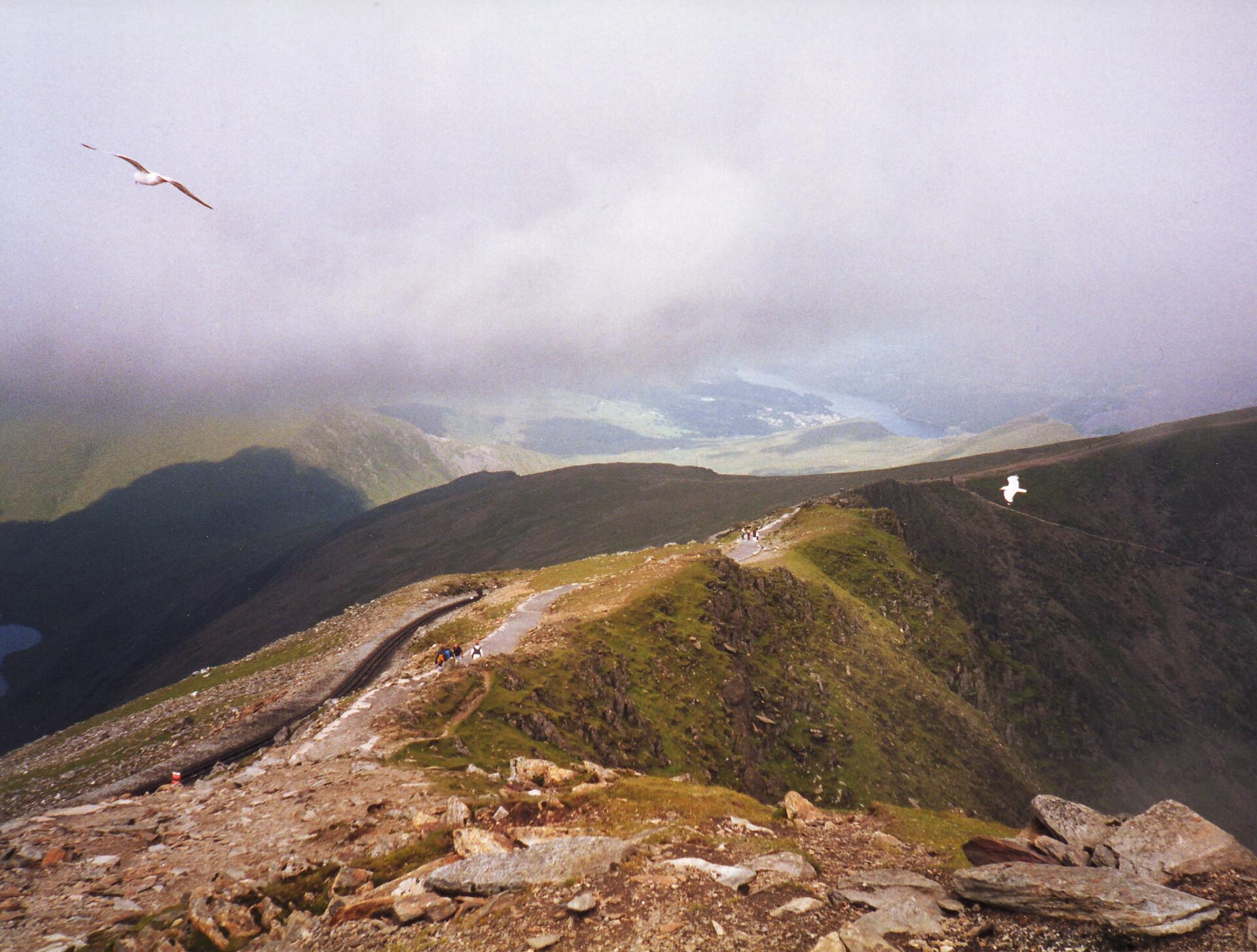
The Llanberis Path is the longest of the six paths up Yr Wyddfa and the one most walkers use for a first ascent. It leaves the village along Victoria Terrace, past the Snowdon Mountain Railway’s own station, and follows a tarmac lane for the first three-quarters of a mile before turning onto open hillside through a mountain gate. From there it runs close to the railway line for almost its entire length; walking on the tracks themselves is not permitted.
For the first half, the gradient stays gentle by the standards of the mountain. At the summit Hafod Eryri, the visitor building the national park authority opened in 2009, replaced the 1930s building designed by Clough Williams-Ellis that Prince Charles once called the highest slum in Wales. Beyond it the path steepens past Clogwyn, where the railway has an intermediate station, and the ground grows rockier on the approach to Bwlch Glas, the col where the Llanberis and Snowdon Ranger paths, already joined, meet the Pyg Track and the Miners’ Track for the final few hundred metres to the summit, Yr Wyddfa, at 1,085 metres.
Of Yr Wyddfa’s six main routes, this is generally reckoned the least technically demanding: the path is wide and well graded, with no scrambling, though above Clogwyn station it crosses the Killer Convex, a steep slope above a long drop where four walkers died in February 2009. It is still a full day out, and the Eryri National Park Authority gives it as 14.5 kilometres and 975 metres of ascent there and back, about seven hours, so fitness and navigation matter.
It suits a first Welsh mountain, a walker who would rather not scramble, and anyone who wants a summit café, though not a booked ride down, since the railway sells down tickets only at the summit. It is the wrong route for anyone after solitude beside a railway, or for a party hoping to be off the hill quickly. For a quieter day on steeper and rougher ground, Moel Hebog above Beddgelert is a different mountain rather than a similar one.
Underfoot
Tarmac lane past a cattle grid for the first three-quarters of a mile, then a wide path alongside the Snowdon Mountain Railway, steepening over rockier ground near Clogwyn before the final boulder field below the summit ridge.
Stay within reach of the start
Booking through these links earns a commission. The price is the same.
Distances, ascent and times here are planning figures taken from published sources, not a route description to navigate by. Take a map and check the forecast.