Win Hill from Ladybower
Near Castleton, Peak District
- Distance
- 12.2 km
- Ascent
- 485 m
- Time
- 5 hr
- Difficulty
- Moderate
- Summit
- 463 m
- Shape
- Circular
Start: Yorkshire Bridge, near Ladybower Dam
Grid ref: SK 201854
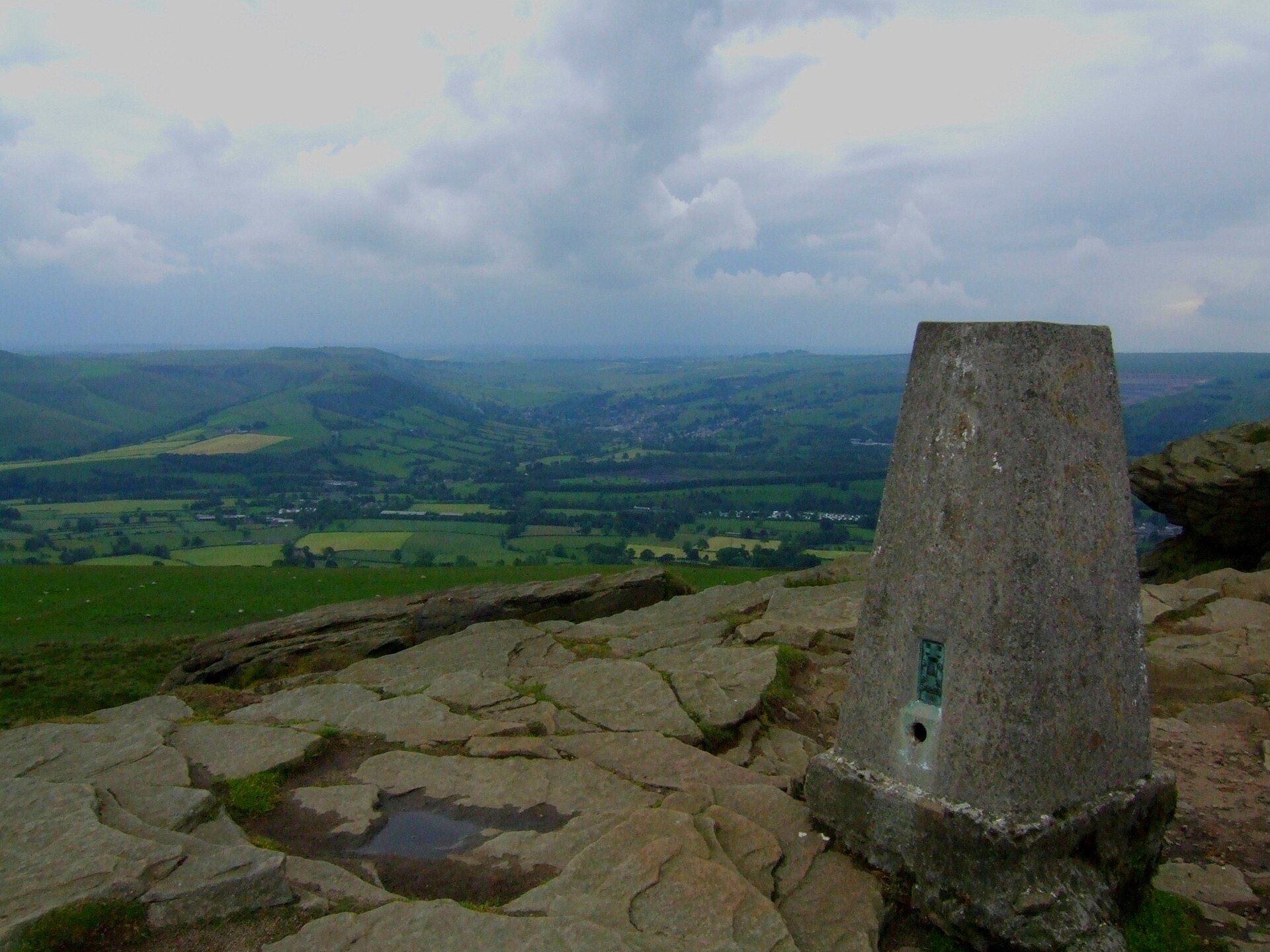
Win Hill stands at 463m above Ladybower Reservoir, the Ordnance Survey height reproduced in the Database of British and Irish Hills, and its name carries a story the record does not support. Local tradition holds that Edwin of Northumbria’s army camped here in a seventh-century battle against Cynegils of Wessex, rolling boulders down on the Wessex ranks camped opposite on Lose Hill; Great British Life reports plainly that no credible historical evidence places any battle in this part of the Peak District. The more likely origin is duller and better attested: early spellings render the hill “Wythinehill”, willow hill, a description of what grew on its flanks rather than a battle honour.
The standard route climbs from Yorkshire Bridge, a stone crossing of the River Derwent near the dam, up the steep, tree-rooted path beside Parkin Clough. Ramblers, whose route notes describe the climb as “much huffing and puffing” before the gradient eases, marks the trig-point summit at SK187852. From there the walk continues west along the ridge to Hope Cross, an old guide stoop above the Vale of Edale, before descending to Ladybower Reservoir’s shore and crossing the dam itself, a route that runs to 12.2km and 485m of ascent over around five hours, according to Walking Britain’s route description. On a clear day the summit gives an open-air map of the district: Stanage Edge to the east, Derwent Edge and its outcrops to the north, Kinder Scout beyond Edale to the north-west, and the ridge of Lose Hill, Hollins Cross and Mam Tor filling the view west above Castleton and Hope in the valley below.
This is a full day’s walk rather than an afternoon out, and the initial climb rules it out for anyone wanting an easy warm-up: it is steep and slippery when wet. It suits anyone after a view over the whole Hope Valley who wants neither Kinder Scout’s pathless plateau nor any scrambling. For less climbing and a shorter day with comparable views over the same valley, Mam Tor and the Great Ridge start a few kilometres to the south-west at less than half the ascent.
Underfoot
A steep, often muddy climb through woodland beside Parkin Clough, exposed tree roots underfoot, onto open moor and a trig point; the return follows a ridge path west then drops to the Ladybower Reservoir shoreline and crosses the dam.
Stay within reach of the start
Everything here is inside 12 km of Win Hill from Ladybower.
Distances, ascent and times here are planning figures taken from published sources, not a route description to navigate by. Take a map and check the forecast. We do not publish conditions, because nothing on this page is updated often enough for you to trust it on the day.